England’s beauty lies in small places, tangled pathways, covered gates
England by Kate Harrison, We bring you a king with a head of gold: dark britannica ii
Pilgrimage is something that has always been interesting to me, not just the journey, but the knowledge that it embodies. The mapping of a landscape with history, and lives of the past which in someway inherently sanctifies those places, and the web of place-connections in the minds of people that live their day-to-day lives moving in and out of that web. It, in some tangible way turns the most mundane location, a farmers field, a back alley, even a Pret a Manger (spoiler alert) into something greater, a place where we can physically be closer to the lives of the past. Not in the way we are when we look at artifacts in a museum, but in a living and numinous way, you stand under the same sun, the same stars, feel the same winds, the same earth, you can even struggle up the same hills and fields.
It wasn’t until I first started reading Blain and Wallis’ Sacred Sites: Contested Rites/Rights (2007) that I first started applying these ideas to sites from the Roman and pre-historic world. A Romano-British site like Aquae Sulis, Hayling Temple with it’s pre-Roman shrine phase, or Maiden Castle Temple as it is sited in the pre-historic Hillfort have as much right to the sanctity and draw of any shrine of St. Thomas Becket or St. Winefrede’s Well.
That claim is half the reason this project exists, I wanted to provide a source of information that would allow people to discover their own ‘sacred landscape‘ which goes beyond the usual Saints’ shrines. Then start to look at how these structures, landscapes, and lives all inter-weaved with each other.
This all being said, on the 11th of December I decided to put my thoughts into action and do some field work, I planned a route through central London which would hit several sites relevant to this project, and then I went ahead and did my own kind of mini-pilgrimage through the wet and grey streets of London.
I knew all the locations from satellite imagery, but I wanted to assess a few things, how accessible are the sites? i. e. how close can we get to the original location of the sites as pedestrians, and what’s the character of the modern site?
First of all, let’s go over the route. We hit 11 spots in the following order beginning from Waterloo Station:
- The statue of King Alfred at Trinity Church Square
- Tabard square temples at Hankey Place Gardens
- London Bridge Temple at Southwark, 11-15 Borough High St
- St. Dunstan’s Hill ‘Shrine’ at Lower Thames Street
- Colchester House at Tower Hill Garden
- The Flavium Forum Temple at Bell Inn Yard
- The London Mithraeum and Bucklers House ‘Shrine’ at the Bloomberg Building
- 54-56 & 30 Gresham Street Temples
- Goldsmith’s Hall at Foster Lane
- The Old Bailey on Warwick Lane
- The Salvation Army HQ at Peter’s Hill
The whole route was about 9 km and took us the day (with a few stops for coffee), especially in December when it gets dark around 15:30. So plan for that if you’re going to give it a go, you can get the route here.

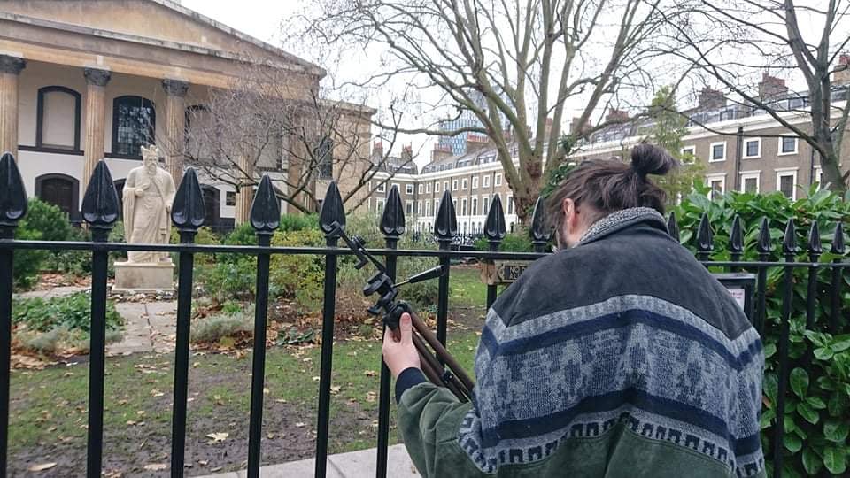
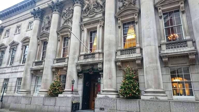
Station 1 – King Alfred, Trinity Church Square
This is a rather recent find, earlier this year a statue of King Alfred located at Trinity Church Square outside Henry Wood Hall was examined by Pre-construct Archaeology. They discovered that the lower part of the statue is not actually contemporary with the upper half, the lower half was dated to between 80 AD and 130 AD, and almost certainly the goddess Minerva. Very probably from the Tabard Square temple complex which is just to the north. You can read the details here.
The statue itself is inside a gated garden locked to everyone but local residents, so for better or for worse you won’t be able to get up close to take a look unless you know a local.

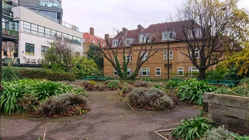
Station 2 – Tabard Square Temples, Hankey Place Gardens
Our second station is just under 500 metres to the north east. This area is Tabard square and is now largely made up of public gardens, blocks of flats, as well as a gallery, and theater. In the past it was the site of a Temple Complex made up of two temples with a guest house added on later, it’s also the site of one of the few dedications to Mars Camulus in Britain, a deity which Camulodunum (modern day Colchester) may be named after.

PCA Monograph 18
I haven’t been able to get a hold of excavation reports that would allow me to pinpoint the exact locations of the two temples, but the site report in the ADS gives us the grid reference TQ326796 which narrows it down to a 100m x 100m space around Tabard Gardens and Hankey Place Gardens (aptly on Pilgrimage Street).
When we arrived the gates to Hankey Place Gardens were left unlocked, I can’t guarantee they will be there if you arrive.
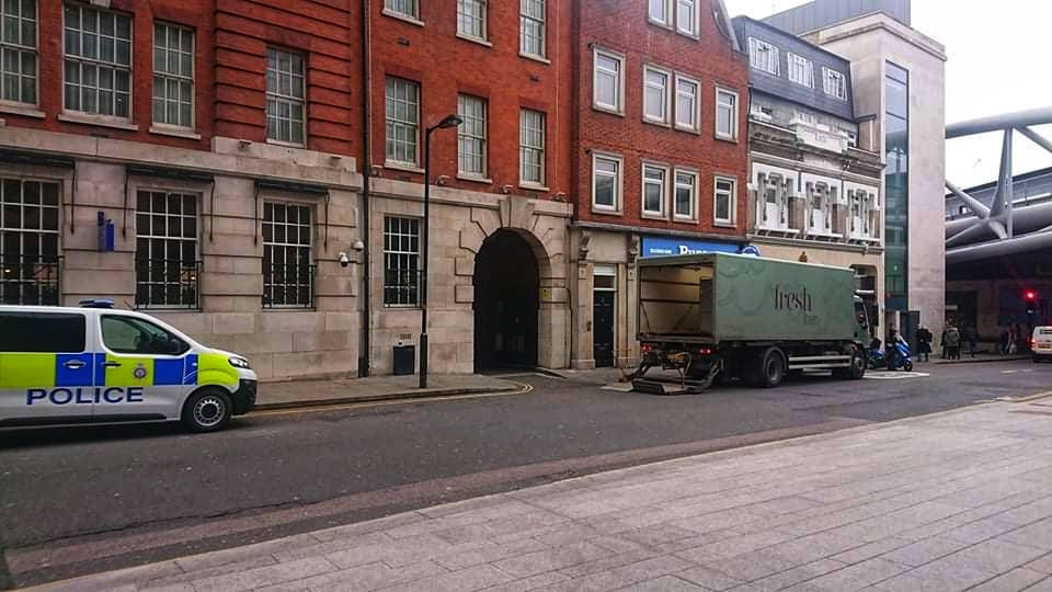
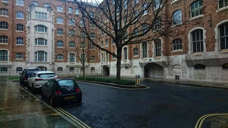
Station 3 – London Bridge Temple, Southwark, 11-15 Borough High St
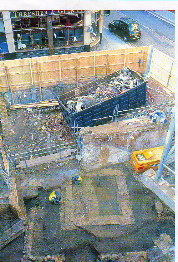
The third stop is a site that has been interpreted as a Romano-Celtic temple built some time in the later first century on the location of a Flavian period ‘mansio‘. There aren’t too many sources for this one but of note is a a column base with a dedication to Silvanus, who was associated with the woods and uncultivated land. It may be relevant that a site was dedicated to Silvanus here at the Southern banks of the Thames, the under-developed side before crossing the river into Londinium proper.
Hingley (Hingley. R, (2018), Londinium: A Biography) gives us the address of 25 London Bridge (featured in the image) as the location for the excavations which discovered the temple and an associated bath house just down the road around 2 London Bridge Street.
The site itself is quite busy and bustling, tucked as it is between the Shard, Southwark Cathederal, and Borough Market.
Station 4 – St. Dunstan’s Hill ‘Shrine’, Lower Thames Street
Station four is a really mysterious one, the site was excavated in 1967 and given the site code GM163. It was described as a small ‘temple-like building’ forming a single room with an easterly facing entrance and was contemporary with a bath-house just to the east. The most interesting bit is that the walls appear to have been traced with red lines on a pink background speckled with red splashes, making it one of the few sites where we have evidence of colour.
Unfortunately I haven’t been able to trace the sources very far back before I became limited by a lack of digital records (or my own googling skills). So, I’ve gone with the location as it appears on the ads report here.
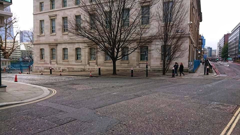
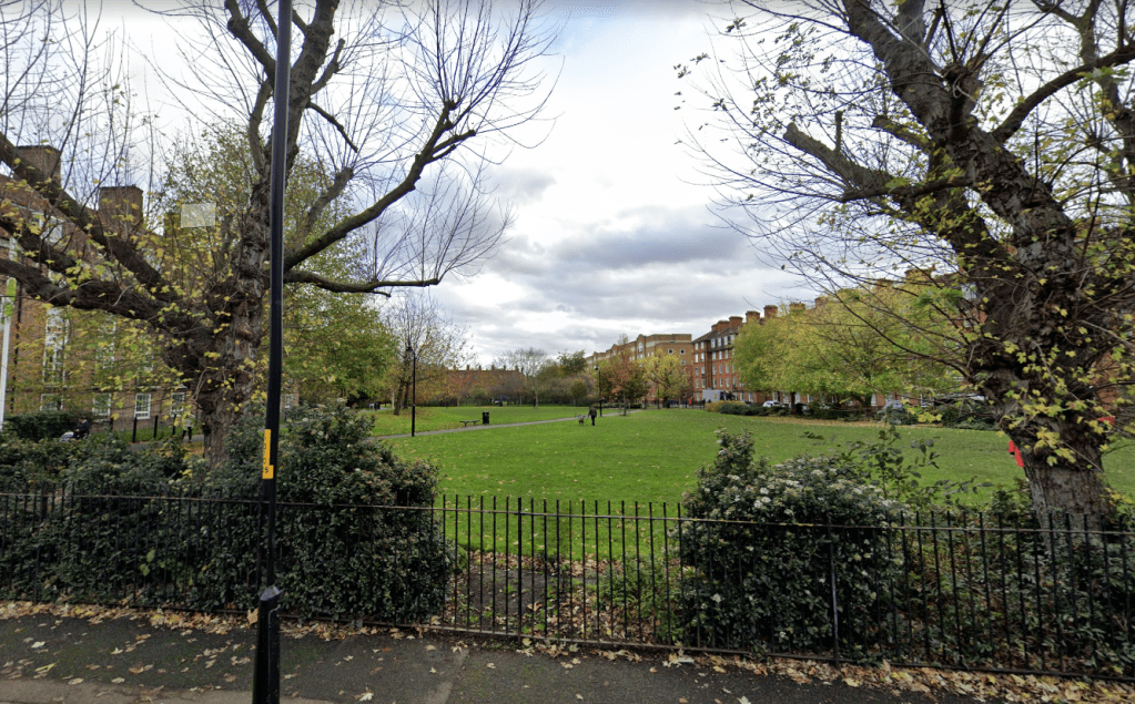
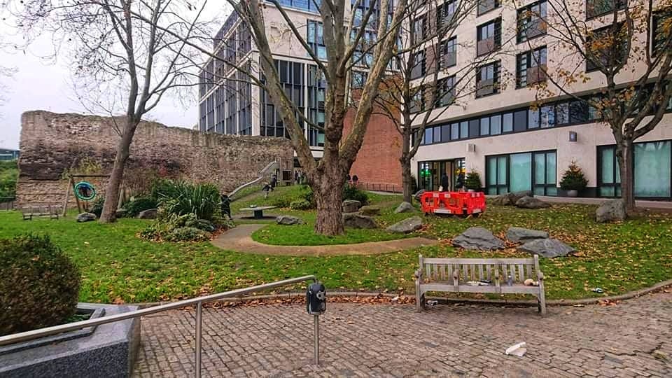
Station 5 – Colchester House, Tower Hill Garden
At our fifth station an aisled building dating to the mid fourth century was discovered in 1993. The building has compared to the Cathederal of St. Tecla in Milan, and if the comparison is apt, may be one of the earliest churches in Roman London. However, the interpretation is difficult, and it may be a building used for grain storage, which just goes to show the difficulty in creating a pilgrimage route like this.
Church or not, the spot is great, it’s a park just behind the tower of London which includes a memorial for Mercantile Marines, a statue of Emperor Trajan, and a standing portion of the Roman wall of Londinium. However, the church itself would of been somewhere further to the north in the block of buildings going towards Pepys Street, but it’s hard to say where exactly.
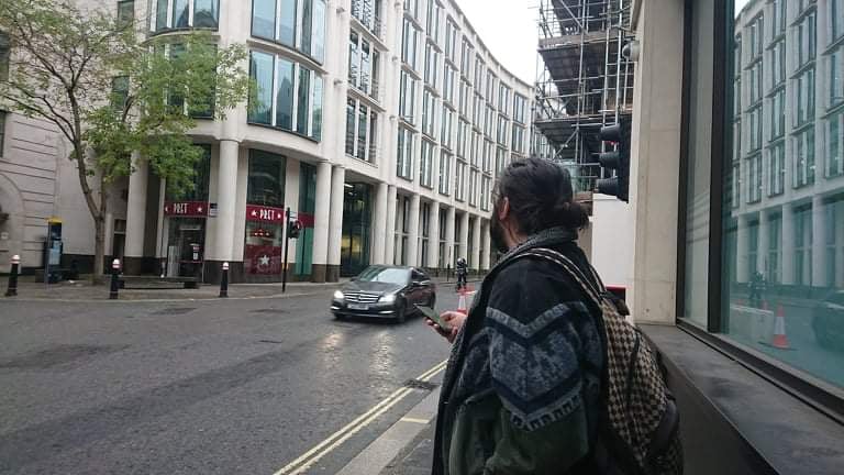
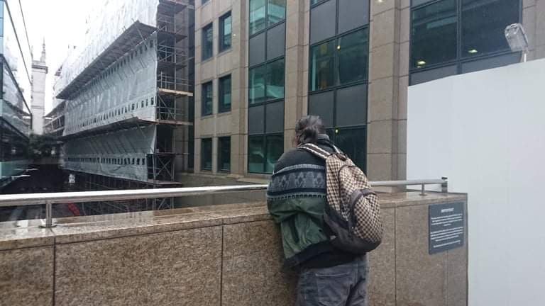
Station 6 – The Flavium Forum Temple, Bell Inn Yard
Station six is the small classical style temple which was located just to the east of the first Flavium Forum built in the east of Londinium. it actually wasn’t around for long, it as built sometime around 75 CE and demolished when the second, much larger forum was built, at the latest around 130 CE if not earlier.
We have a good idea for exactly where this temple stood because I was able to get hold of the site diagram and align with the modern buildings that are still there.

You can see that the modern site is pretty much inside the office building, but the closest we can get to it is by entering Bell Inn yard behind the building and facing the back corner you can see in the images. You can also see just a few metres to the west of where it would of stood is St. Edmund’s Church, first recorded in the 13th century.
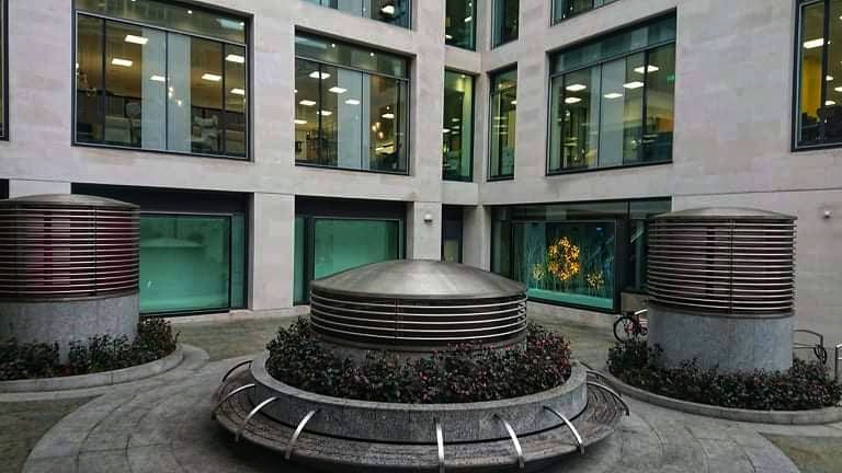
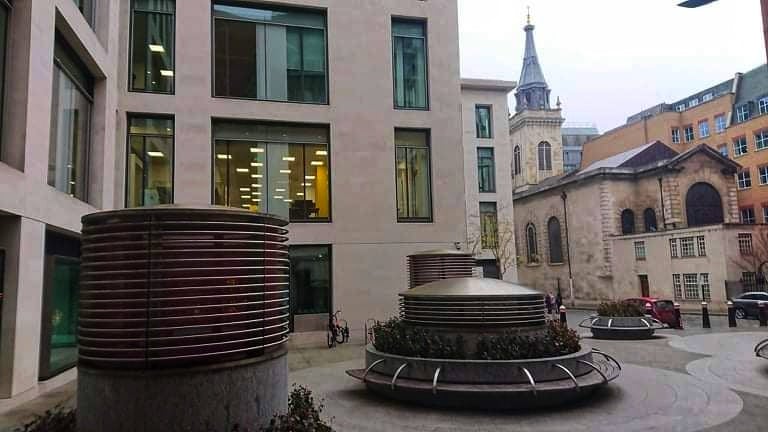
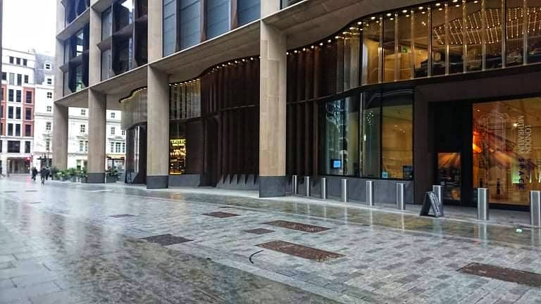
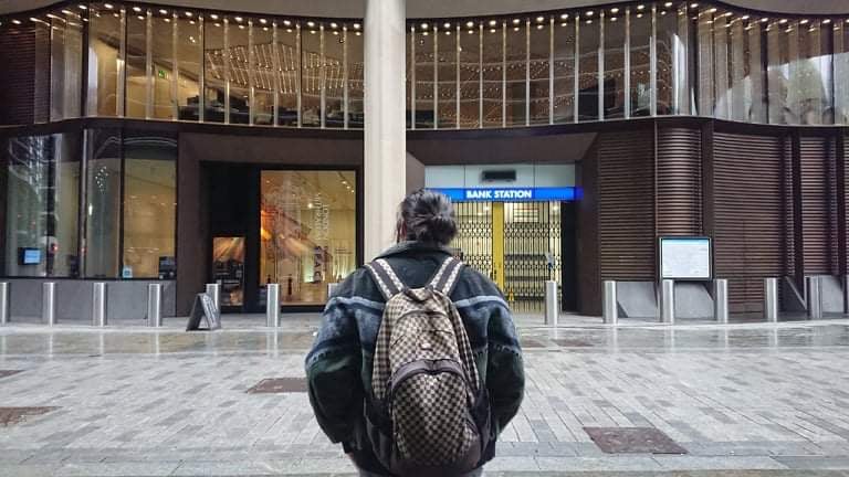
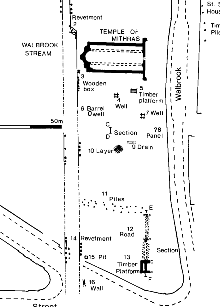
Station 7 – The London Mithraeum and Bucklers House ‘Shrine’, Bloomberg Building, Walbrook
This is one I’m sure that you’ll recognise. The site was excavated 1952 – 54 and was in-fact the site of a WW2 bomb blast, so it’s wonderful we have as much surviving as we do. As soon as the excavation went public it became a bit of a sensation, with apparently up to 30,000 queuing on days to get a look (take that with a grain of salt, London Mithraeum 2018). In 1962 the developer agreed to reconstruct the temple 100m to the north to preserve it, apparently they did a poor job of it and the job was widely criticised. So much so, that when Bloomberg acquired the building in 2010 they moved the temple again, back closer to where it originally stood and worked to recreate the original form of the temple as a publicly accessible space, which is how it stands today.
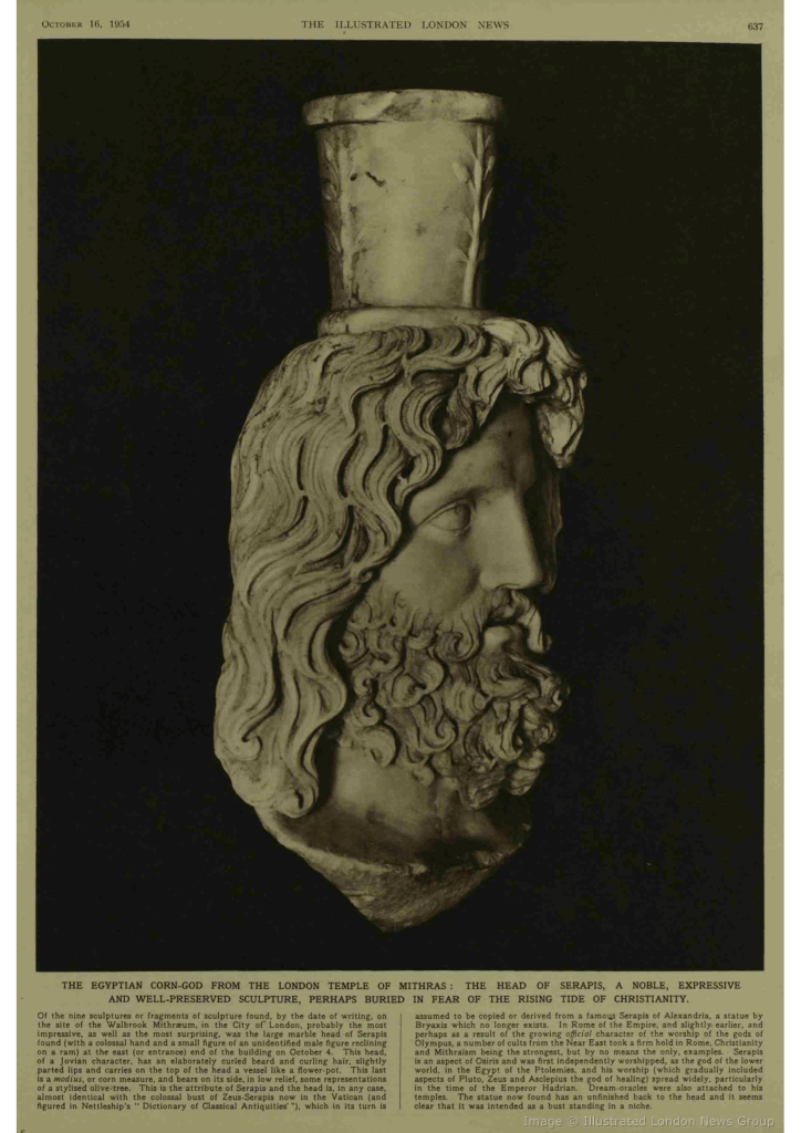
Apparently the temple as it stands today, is constructed today is supposed to reflect how it would of been lane out around 240 CE when it was first founded “before later additions” (London Mithraeum (2018)). I’m not sure how I feel about that, while they have done a great job I think I would have liked to see some more acknowledgment of the later additions, especially the late fourth century re-dedication to Bacchus, as well as the other gods and goddesses that were apart of the site, Minerva, Mercury, and Serapis.

Other than it’s famous cousin, there’s a smaller, less well known site which pre-dates the Mithraeum. The Bucklersbury House ‘shrine’, otherwise known as ‘feature 8’, is a small wooden structure that stood on the edge of the Walbrook, decorated with arcaded and ribbed wood paneling and holding a face-pot, it was destroyed by fire at some point in the early 2nd CE but has traditionally been interpreted as a small shrine of some type. You can see it in this site plan below.
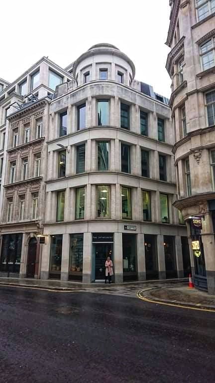
Station 8 – 54-56 & 30 Gresham Street Temples
Our eighth station lays to the north, just south of Guildhall Yard, where the amphitheatre once stood. This temple was excavated in 2006 and is now under a bar and restaurant called The Anthologist, so if you’re in the mood you could stop in here and have lunch over the cella of a temple. Unfortunately, when we were there it looked like the whole thing was rented out for a Christmas Party.
Just up the road from our eight station is number nine at 30 Gresham Street, now a Pret a Manger. This site pre-dates the former and unfortunately only the north-west corner of the colonnaded building has been excavated, but judging by the size of that corner it would of been quite large and the centre of the structure is probably somewhere off King Street, perhaps the State Bank of India? The temple burnt down sometime around the year 120 in the Hadrianic fire.

Station 9 – Goldsmith’s Hall, Foster Lane
A couple of minutes walk west along Gresham Street and we get to Goldmsmith’s Hall, it was at this location a second century altar with an image identified as Diana was found. Later on some roman Masonry foundations were recorded so it has been identified as a possible temple, but further excavation would be necessary before we could say much more.
Station 10 – The Old Bailey, Warwick Lane
In quick succession we reach our tenth station for the day, a large octagonal structure surrounded by an ambulatory constructed sometime after 120 CE under the modern Old Bailey building. The structure has been interpreted as a Romano-Celtic temple, partly because of the ambulatory and partly on comparison with other octagonal temples like Pagans Hill or Nettleton. The fragmentary site was discovered in the 1980s and would have stood on the eastern bank of the river fleet, it also appears to have had a prior history of industrial glass making on the site, which Hingley suggests hints “at a connection between industry and ritual”, but Perring and Brigham seem to prefer a secular use for the site in retrospect.
It was easy enough to get to the rear of the building to Warwick Passage, though we did have to pass signs warning us of Guard dogs.
Station 11 – The Salvation Army HQ, Peter’s Hill
Our final stop and probably one of the more monumental sites. Along the back of the Salvation Army HQ and Castle Baynards Street going towards Lambeth Hill, we know that two monumental apses existed on the waterfront with the space to hold a statue each, this operated as the monumental waterfront to a religious complex extending to the north.
Along this street a renovated waterfront wall was constructed in the later third century using material from the complex, this included two alters both referencing the refurbishment of a Temple to Jupiter and a Temple to Isis, both of which ‘had fallen down through old age’ and date from mid third century.
After this waterfront wall had been constructed two large temples that roughly correspond to the location of the former apses in the year 294. The temples were never finished, it has been suggested the construction was initiated by Carausius as a project to promote his authority during the Carusian Revolt and that the project was never finished due to the assassination of his successor Allectus and the re-conquest of Britain in 296 CE.

Unfortunately we couldn’t find a path to get down to the ground level, Castle Baynard Street has no pedestrian access and besides it’s walled off so we wouldn’t be able to get into the street behind the Salvation Army building.
That concludes are mini pilgrimage through London’s religious history! The route I used is publicly available here, and as usual you can find more information about all the sites I discussed here at the Templum website.
